Every occurrence record on the NBN Atlas has its own page containing all the associated information and metadata related to that record. You can find occurrence records by using one of the available search options available on the NBN Atlas.
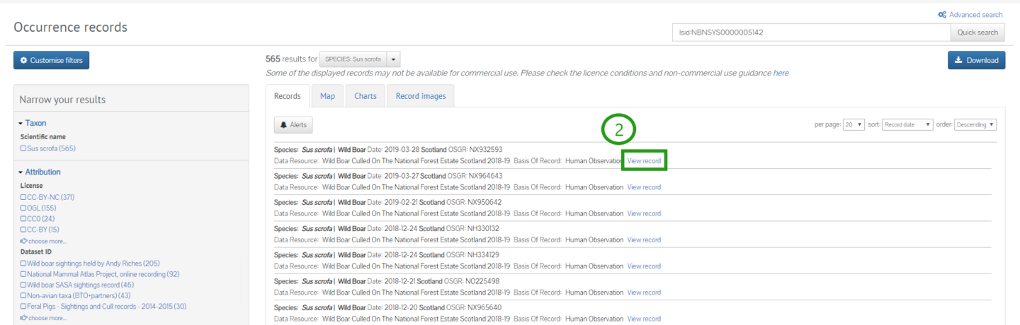
When you navigate to an occurrence search, you will be presented with a list of all records for that search. Click View record (2) to learn more about the record.
You will be directed to the record's page, which contains lots of information about the record, arranged into different categories.
You will find basic details of the record at the top (3). You can flag an issue or contact the data provider (4).
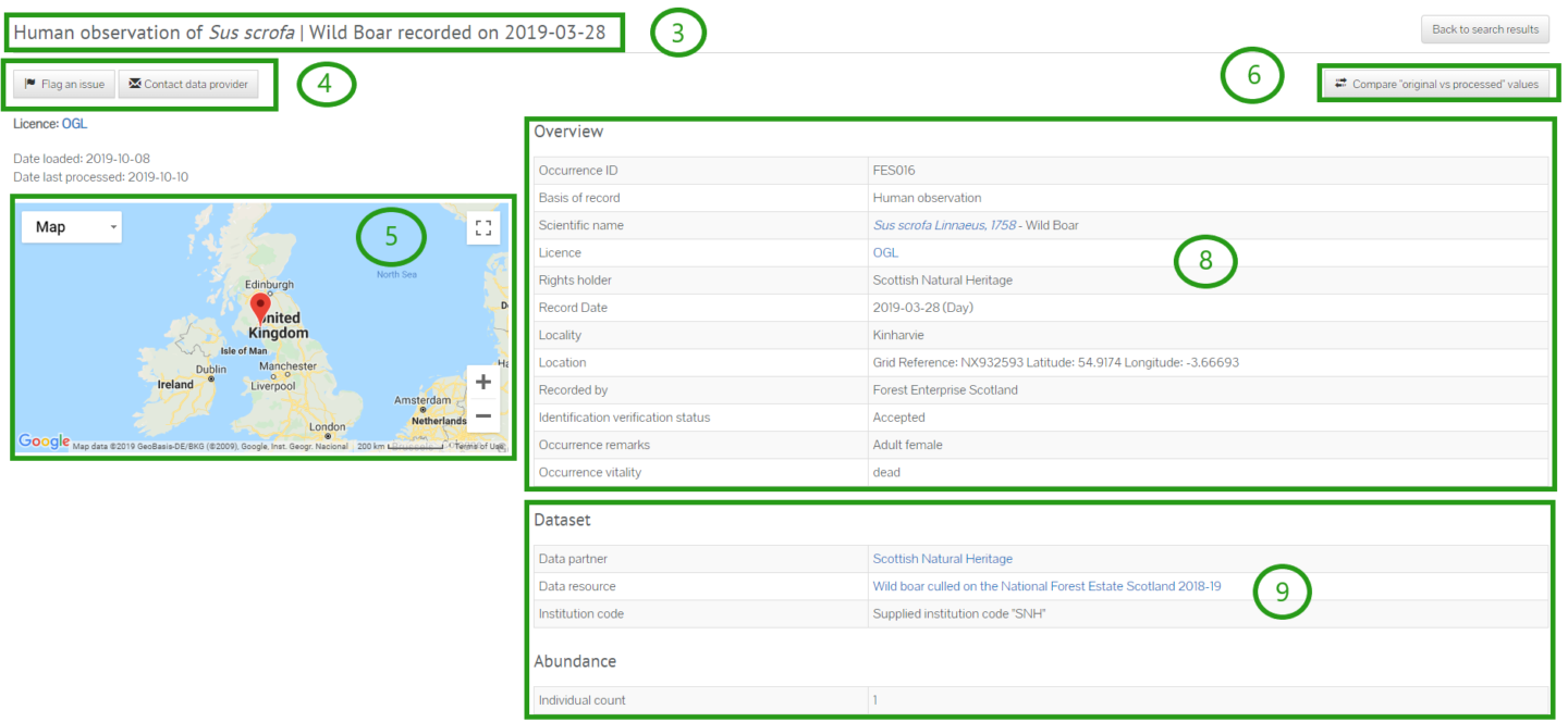
The location of the record is shown on a map (5), and you can zoom in and out of the map. An spatial uncertainty radius is also displayed around the location pin on the map.
All data in the NBN Atlas are processed to make sure the formatting is consistent as possible. To see if and how the data for a record have been adjusted from the original entry, click Original vs processed (6). You will then see a table showing a comparison of the original and processed record.
In the main body of the species record page, the first section is Overview (8). This section lists information about the record such as the licence associated with it, the record's location, record's date, and the data partner (provided the record), and rights holder (this can sometimes be different to the data partner).
The next section is Dataset (9), which tells you about the dataset the record comes from.
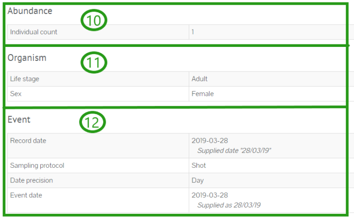
The next sections are Abundance (10), Organism (11) and Event (12).
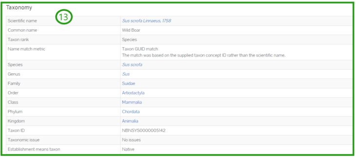
In the Taxonomy section (13), you will find details such as the scientific name and common name of the species. You will also find its taxonomic ranking.
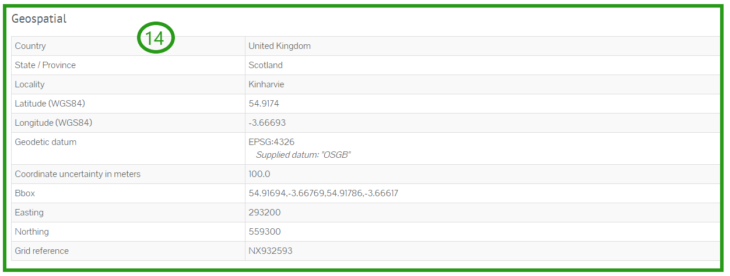
The next section is Geospatial (14), where you can find out more about the location of the record.
The Data quality tests (15) flag up any potential issues with the data, such as uncertainty surrounding the date or location.

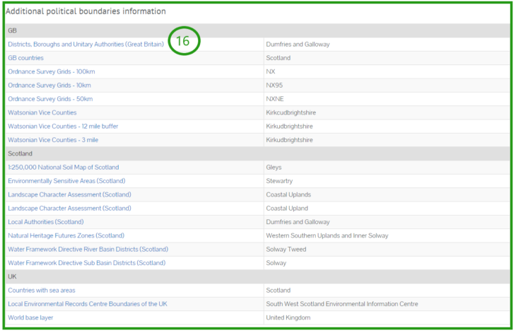
The final section is Additional political boundaries information (16). Here you will find additional details on the political boundaries affecting the location of the record. These include any special status applied to the land such as National Park or SSSI status, Watsonian Vice County designation and the relevant Local Environmental Records Centre.
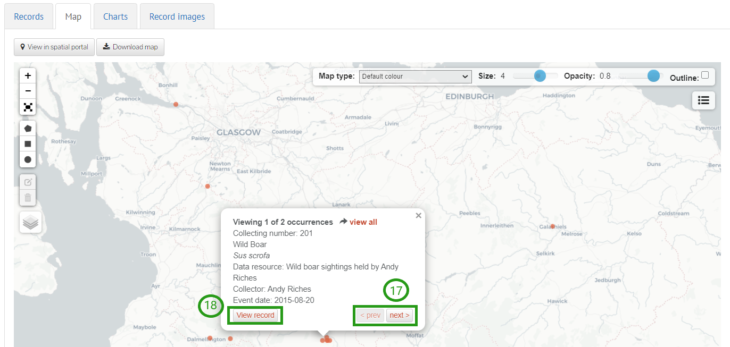
Individual records can also be accessed via the interactive map. Click on a record on the map. If there are multiple records at a point, you can use the arrows to view the different records (17). Click View record to access the species record page (18).
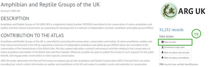
You can also access species records from a Data Partner’s page. Choose the data partner you are interested in from either the map or list of data partners on the United Kingdom’s natural collections page. You will then be directed to the data partner’s page, click View records (19). This takes you to the interactive map of the data partner’s records.
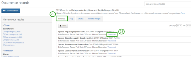
Click the Records tab (20) to view the occurrence records and then select a record by clicking View record (21).
Was this article helpful?
That’s Great!
Thank you for your feedback
Sorry! We couldn't be helpful
Thank you for your feedback
Feedback sent
We appreciate your effort and will try to fix the article