Areas are one of four main data types in the Spatial Portal, along with species (taxa) and layers. Areas can be defined by 14 different options. When an area gets defined, it is added to the map; a new layer is added to the layers list.
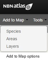
Areas are a persistent option associated with the display or analysis of species (taxa).
NOTE: When dealing with complex polygons, please be aware that your polygon/s may be generalised by the spatial portal (including pre-existing layers on the NBN Atlas, or layers which you draw or upload to the spatial portal). The spatial portal can only process polygons with 5,000 vertices (joins in a polygon). If your shapefile exceeds this limit, we recommend drawing a simplified polygon, in the spatial portal, around your polygon/s or simplifying your polygon/s in a GIS software (e.g., QGIS). If you need support with simplifying your polygon/s, please submit a ticket.
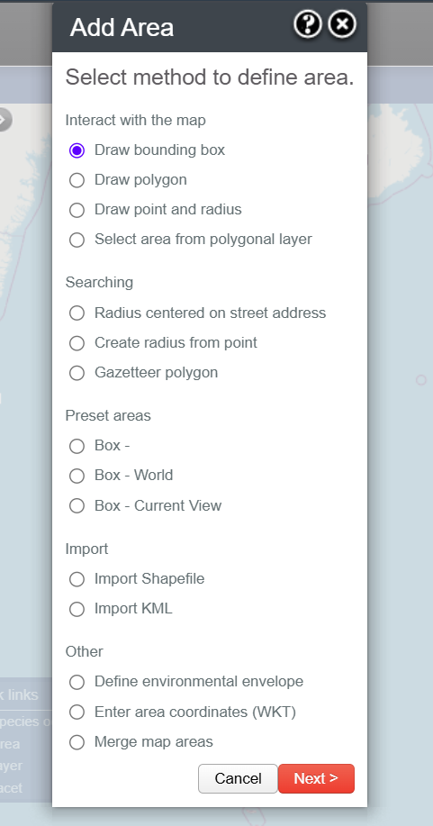
There are several ways to add an area to the map (grouped into five main categories):
- Interact with the map
- Searching
- Preset Areas
- Upload
- Other
- 10. Enter area coordinates (WKT)
- 11. Merge map areas
Interact with the map
Interact with the map – allows the user to draw a region directly within the Spatial Portal. Sub-options available include drawing a bounding box, a polygon, a point and radius, or to select a pre-defined polygon area from a contextual layer that has already been mapped.
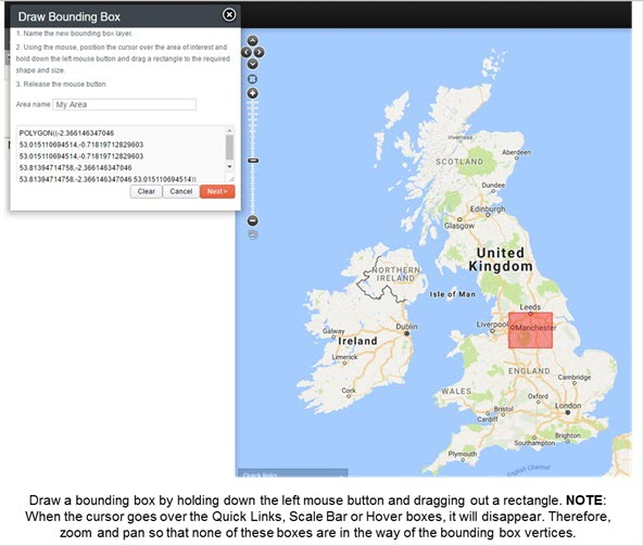
1. Draw bounding box
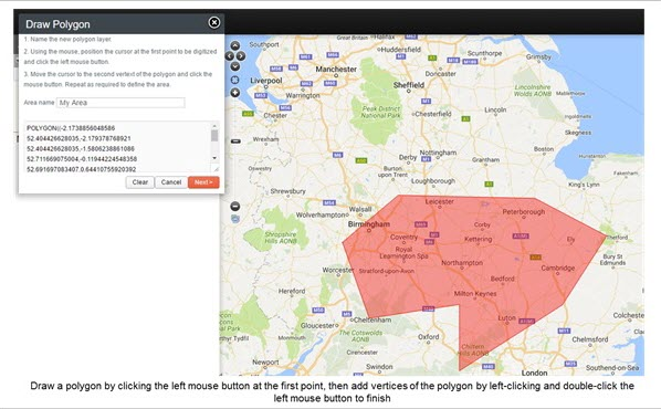
2. Draw polygon
3. Draw point and radius
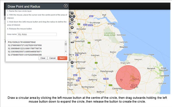
NOTE: The radius of the circle will be (dynamically) displayed on the top of the map window as you drag out the radius.
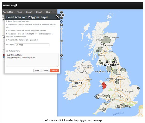
4. Select an Area from Mapped Polygonal Layer
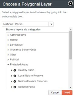
Select an area from a polygonal layer either by typing in the autocomplete text field, or by navigating the hierarchical tree of polygonal (contextual) categories.
Searching
Searching allows the user to create a point and radius based on a Google geocode (address) lookup or search for a pre-defined polygon using the ALA gazetteer service.
The radius functions are a work in progress, at the moment polygons are being produced instead of radii.
5. Radius Centred on Street Address or Known Facility
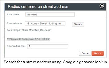
Enter an address and press “Search”, a successful geocode lookup will allow you to define a radius in kilometres (default is 1km). Press “Next” to add the location to the map. You can change the name of the “My Area” in the first text field.
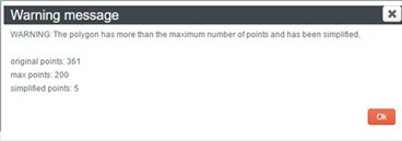
You may get a warning message (see below) if so just click “Ok”.
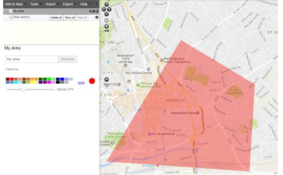
Use the zoom to extent button (magnifying glass) in the layer options to zoom in to the new area as pictured below.
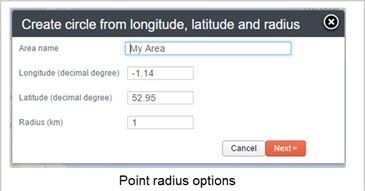
6. Create radius from point (latitude, longitude)
This option requires that you enter:
- The name of the area (this is what the layer produced will be called)
- A longitude in decimal degrees
- A latitude in decimal degrees
- A radius in kilometres
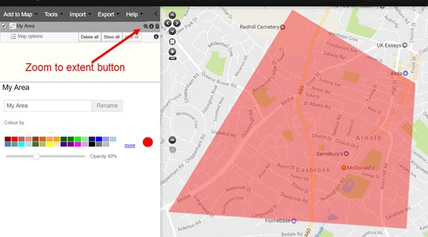
An area with the specified radius is then generated at the specified location.
7. Gazetteer polygon
The NBN Atlas Gazetteer named points that can be added to the map.
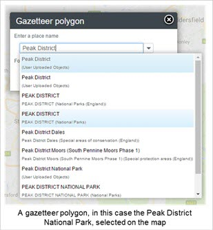
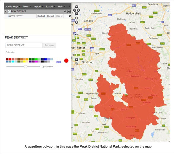
Preset Areas
Preset Areas allows the user to select the entire world, just the UK or the current map view.
8. Box – World
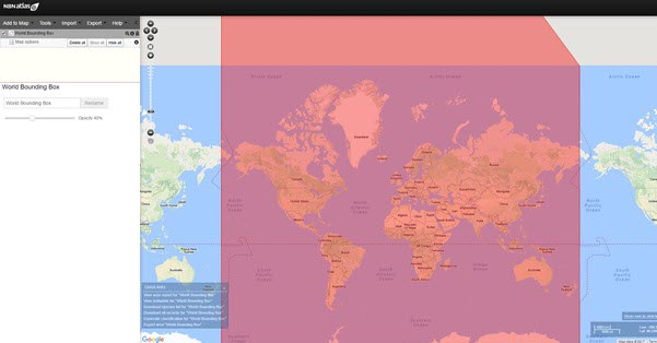
A bounding box is drawn around most of the world.
However, the standard projection used by the Spatial Portal does not permit the use of a bounding box > ~85 degrees north and south of the equator.
9. Box – Current View (extent)
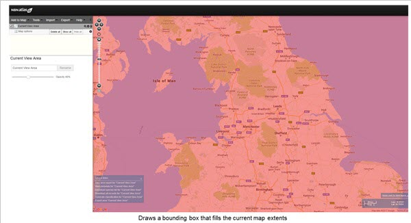
Whatever is visible in the map, whether you are zoomed in or out, is the current view of the map. Also known as the current extent. Selecting Box – Current View draws a bounding box around this extent.
Upload
Upload allows the user to upload either a zip file containing an ESRI shape file or Google Earth KML polygon definition.
- Upload Shapefile
- Upload KML
NOTE: The spatial portal can only handle layers with 5,000 or less vertices (joins in a polygon), if your polygon/s exceed this limit your polygon/s will be simplified.
Other
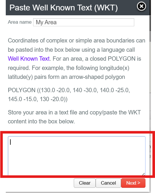
10. Enter area coordinates (WKT)
Paste a Well Known Text (WKT) string into the text box and click the Next button.
11. Merge map areas
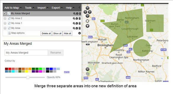
This is a new option that permits a set of predefined areas (each defined by a layer on the top-left of the Spatial Portal window) to be merged into one new layer that contains all the areas. This allows for great flexibility in defining areas. For example, an ‘area’ could be made of up a number of discrete IBRA regions or digitized polygons or imported with areas defined in the Spatial Portal.
The example below was generated by first digitising three separate areas (rectangle, polygons and circle) and then using this option to combine the three separate areas into one new definition of area.
Was this article helpful?
That’s Great!
Thank you for your feedback
Sorry! We couldn't be helpful
Thank you for your feedback
Feedback sent
We appreciate your effort and will try to fix the article