TABLE OF CONTENTS
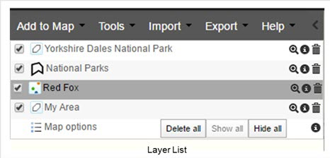
A new entry is added to the layer list for each layer added to the map; species, area or layer. All layers have a set of associated functions.
Layer List Panel
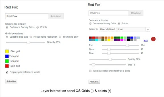
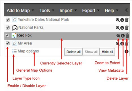
The layer list panel reveals the features that are associated with each layer.
Layer Types
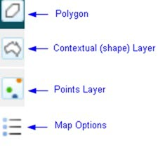
The different types of layers can be identified by the icons to the left of the layer name. Species are usually (occurrence) points but can be polygons in the case of checklists (list of species within an area) or ‘expert distributions’. Areas are polygons. ‘Layers’ are contextual, containing polygons that are described by a class.
There are links between the data of type ‘Areas’ and the data type ‘Layers’ when the layer is a contextual layer.
Quick Links Panel
As layers are added to the map, a list of potential actions will be listed in the Quick Links Panel. Selecting a ‘hint’ will initiate the action and take you to the appropriate step of the wizard to add in the extra information.
The hints operate on the highest layer of the particular type (species, area or contextual layer) shown in the list. So the topmost species, topmost area and topmost contextual layer of the layer list have hints applied to them. Layers can be reordered by clicking a layer to select it, then dragging it up or down thereby causing the hints to change.
The hints are indicative rather than all inclusive. The hints try to predict the likely actions the user will want to carry out, based on the layers added to the map.
Each of the layer types have their own set of actions added to the hints. However, if both species and areas are added to the map, then their hints combine.
Summary of hints for layer type:
Layer
- View Metadata for the layer
Area
- View Metadata for My Area
Species
- View Metadata for the Species
- Download All Records for the Species
Area and Species and Layers
- Area report
- View Metadata for My Area
- View Metadata for Species
- View Metadata for the environmental or contextual layer
- Download Species List for My Area
- Download All records of the Species for the Area
Was this article helpful?
That’s Great!
Thank you for your feedback
Sorry! We couldn't be helpful
Thank you for your feedback
Feedback sent
We appreciate your effort and will try to fix the article