This page will provide an overview of Access Controls, covering the following topics:
- What is a set public resolution data resource?
- What record information is affected?
- Identifying public resolution records
- Requesting access to supplied location information
- Managing access to supplied location information
Glossary
| Resolution – The spatial uncertainty of a record based on the grid reference or coordinate uncertainty in meters. See Spatial resolutions guide for guidance on spatial resolution information on the NBN Atlas. Public resolution – The coordinate uncertainty or grid square size that the record is viewable at on the NBN Atlas. For set public resolution datasets this will be 1, 2, 5 or 10km grids. Supplied resolution – The coordinate uncertainty or grid square size as supplied by the data partner in the original datafile. Location – Refers to the grid reference, latitude and longitude coordinates, coordinate-uncertainty and the locality text for a record. Generalised – When the supplied resolution is higher than the resolution displayed on the NBN Atlas. |
What is a set public resolution data resource?
Data partners can specify if they want records in a data resource to be displayed a set public resolution. The public resolution effects the location information of the record, e.g., this can to protect records deemed as sensitive by the data partner. A data partner can request for records in a data resource to be generalised to a 1km, 2km, 5km, or 10km spatial resolution.
What record information is affected?
The table below lists the record information that is affected by a set public resolution and describes how it is affected.
| Field name/s | How the field is affected |
| Grid reference | The grid reference is generalised to the set public resolution. E.g., For a record supplied with a 1m grid reference in a dataset with a 1km set public resolution, the grid reference will be generalised to 1km. If the supplied grid reference resolution is lower than the set public resolution or sensitive generalisation, the supplied grid reference will be used. |
| Coordinate uncertainty in meters | The coordinate uncertainty in meters is generalised to the set public resolution. E.g., For a record supplied with a coordinate uncertainty (m) of 50 in a dataset with the set public resolution 1km, the coordinate uncertainty will be generalised to 707.1 (1km). If the supplied coordinate uncertainty resolution is lower than the set public resolution or sensitive generalisation, the supplied coordinate uncertainty will be used. |
| Latitude and longitude | If values are supplied for the Latitude and Longitude fields, the values will be processed and generalised according to the processed coordinate uncertainty in meters. If no values are supplied for the Latitude and Longitude fields, the NBN Atlas will calculate and display the generalised values according to the processed grid reference. |
| Locality | This field is cleared. |
For records which are both sensitive and have a set public resolution, if the sensitive generalisation is higher than the set public resolution, the sensitive generalisation is applied and vice versa.
Identifying public resolution records
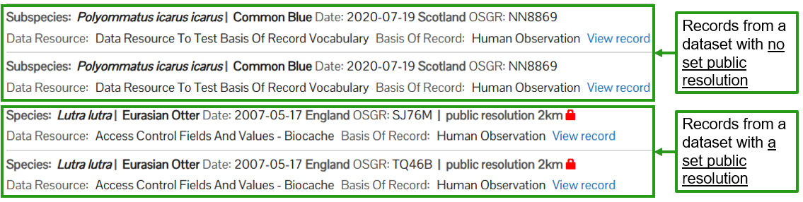
In the Occurrence search records with a set public resolution have the public resolution and a padlock icon next to the records information.
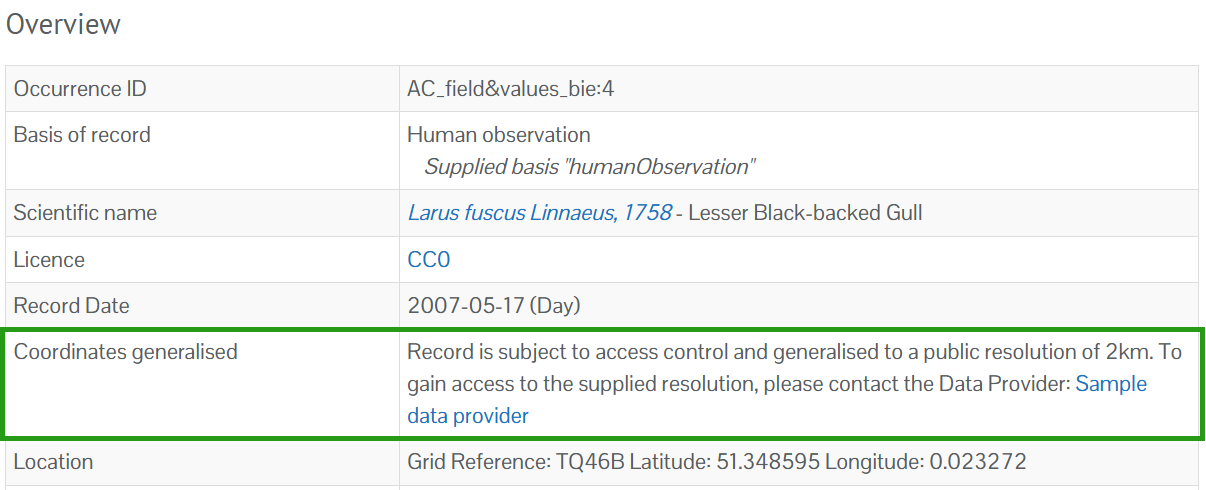
On the record page (click on the View record link in the occurrence search, as shown above), a coordinates generalised field is included. The message informs that the record is affected by a set public resolution and includes a link to the data partner page for the correct contact to request access to the supplied location.
The public resolution information is also included when downloading the records.

You can identify is a records is of a sensitive species by checking the 'Sensitive status' field in the download. If a records is not sensitive the field will be blank.
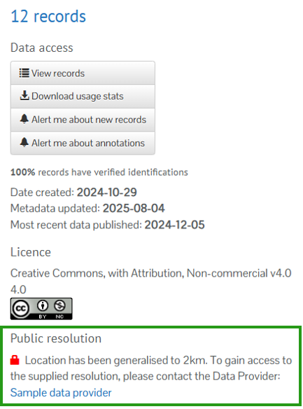
If you are looking at a data resource page, you can also check is the records are affected by a public resolution.
Requesting access to supplied location information
See the Requesting accessing to supplied resolution data guide.
Managing access to supplied location information
Data partners can manage access for NBN Atlas user to download supplied location information. See the Managing and allowing access to supplied resolution data guide.
Was this article helpful?
That’s Great!
Thank you for your feedback
Sorry! We couldn't be helpful
Thank you for your feedback
Feedback sent
We appreciate your effort and will try to fix the article