The Spatial Portal focuses on where a chosen species was located, what species were found in a defined area and what are the environmental conditions in that area.
The Spatial Portal combines three basic data types – species, areas and layers. Species can also include assemblages of species or high taxa (genus, family etc.) as a single mapped layer. Areas can be defined by 14 different options including digitising on screen to importing. ‘Layers’ refer to either environmental (gridded structure with continuous values such as temperature) or contextual (polygonal areas with class values such as a land use layer with a forestry land-use class) geographic data that can be thought of as a layer draped over the map; commonly used in Geographic Information Systems (GIS).
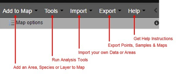
Summary of the Functionality
More information on carrying out each of the functions can be found by clicking the links below:
- Define areas of interest on the map in many different ways including address lookup, defining environmental envelopes and drawing polygons on a map
- Map and list all occurrences of one, many or all species within an area (limits apply)
- Map environmental (gridded) and contextual (polygonal) data layers
- Create an area report summarising the information held by the Atlas for an area
- Produce species lists for a chosen area
- Add layers to a map and interact with the layers
- Save and print maps for offline analysis (as a PNG, JPEG or PDF file)
Was this article helpful?
That’s Great!
Thank you for your feedback
Sorry! We couldn't be helpful
Thank you for your feedback
Feedback sent
We appreciate your effort and will try to fix the article